Himalayan glacier collapse: An Interview with Geologist Ananta Gajurel on the mountain crisis
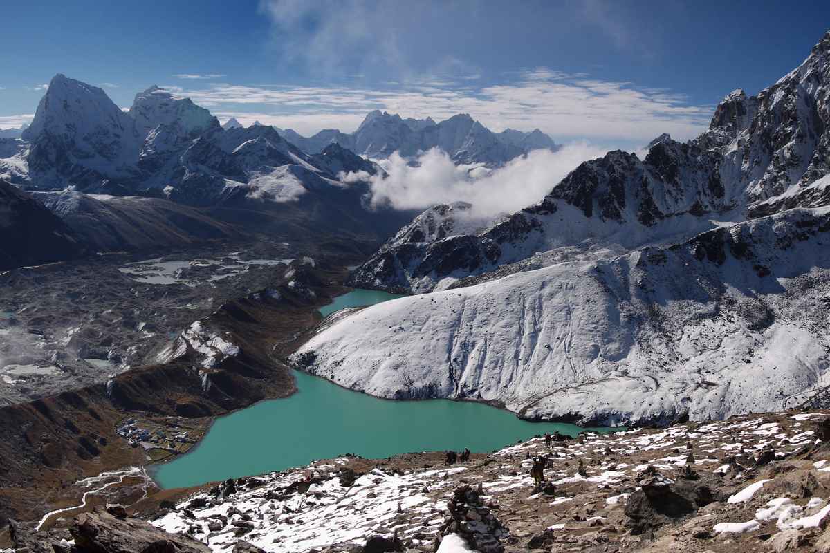
The Himalayas are undergoing a rapid, dramatic transformation. Rising high-altitude temperatures, black carbon deposition, and permafrost thaw are destabilizing mountain slopes, multiplying glacial lake outburst floods, rockslides, and ice avalanches. To clarify the scientific mechanisms driving these disasters and outline critical prevention strategies, we interviewed Ananta Gajurel, geologist and professor at Tribhuvan University in Kathmandu. The expert analyzes glacier retreat in Nepal, the role of human activity, the impact of infrastructure, and the urgent need for direct bilateral cooperation between Nepal and China.
Can the Nepal disaster serve as a global case study on climate change?
Glacier and snowpack melting across the Himalayan region is accelerating due to industrial activity in advanced economies. These activities release greenhouse gases and fine aerosols containing black carbon, which is dark particulate matter produced by the incomplete combustion of fossil fuels.
Carried by air currents to high altitudes, deposited black carbon absorbs solar energy, directly accelerating snow and ice melt. Furthermore, global warming has pushed liquid precipitation as high as 4,500 meters, introducing rainfall as an additional trigger for glacial thaw.
Temperatures in the high-elevation zones of the Himalayas are rising at a rate of 0.06°C per year, a threshold high enough to cause rapid glacial retreat. Depending on their location, glaciers have retreated by 100 to 150 meters. Concurrently, the winter snow line has shifted upward by roughly 150 meters over the past 60 to 70 years, now reaching altitudes of 5,200 meters.
What other factors contributed to the tragedy?
The frequency of cryospheric disasters, such as glacial lake outburst floods, snow avalanches, and ice-rock slides, has surged across Nepal and neighboring India. Recent disasters in Nepal demonstrate a cascading effect where upper-elevation glacial ponds fill to capacity, breach, and trigger the sudden outburst of lower-lying basins downstream.
Slope instability is further driven by permafrost thaw in rocky or debris-covered terrain between 4,000 and 5,000 meters above sea level. Meltwater from rainfall, global warming, and black carbon percolates into the ground, slowly melting deep-seated permafrost ice. This accumulated water acts as a lubricant and builds high pore water pressure within the slope. Ultimately, this pressure reduces the structural
strength of the mountain slope and triggers catastrophic landslides and rock avalanches.
While the exact proportion of human-driven influence remains difficult to isolate, these combined climate factors are clearly driving the increased frequency of glacial disasters across the Himalayas.
Could the recent disaster be connected to the 2015 earthquake?
On April 25, 2015, the Gorkh Earthquake (M w 7.8) struck central Nepal, shaking the eastern slope of the Langtang Lirung area, located about 78 km NNE of the epicenter.
The earthquake triggered a large rock-ice avalanche at around 6000 m above sea level, whiched entrained debris from the slope and carried it down into the Langtang River valley. Scientific research revealed that the event was also enhanced by climate factors.
On August 26, 2026, the Bhotekosi-Trisuli flood (mudflow) origined on the western slope of Langtang Lirung, 11 years after the earthquake. A smaller event than this had already taken place on July 8, 2025, to the north of the site on the western slope of the range, caused by a subglacial lake outburst at around 5150 m above sea level.
In fact, scientific reports of surface fractures directly linked to the Gorkha Earthquake are absent, and the residual effects of the earthquake remain uncertain. Moreover, this zone lies to the north of the rupture area.
Do Hydropower Tunnels Play a Role in Triggering Outbursts?
Hydropower infrastructure and underground tunneling only present a risk if blasting vibrations occur in immediate proximity to perennial glaciers or ice caps. Because hydropower tunnels are not located near active glaciated zones, they do not trigger slope failures or glacial lake outbursts in these high-altitude regions.
How Should Nepal and China Manage Transboundary Hazards?
Nepal and China share a vast cryospheric zone along their international boundary. Numerous high-risk glacial lakes situated on both sides of the border ultimately drain toward the southern slopes of the Himalayas.
While regional organizations like the International Centre for Integrated Mountain Development facilitate multi-nation research across the region, a dedicated bilateral framework between Nepal and China is still missing. Both governments should establish a joint committee to focus on collaborative monitoring of critical glaciers and expanding glacial lakes, the establishment of cross-border early warning systems to alert downstream communities, and real-time data exchange mechanisms between Nepalese and Chinese authorities to manage shared river basin hazards effectively.